


EXPLORE THE RED PLANET
Touch down on Mars: Gravity at 3.71 m/s² awaits your step.
Mars is not just a destination. It is an environment we must understand.
Martian Map synthesizes fragmented planetary spatial observations into a unified, map-centered exploration platform.
From global orbital mosaics and digital elevation contours to in situ rover drill cores, our platform brings planetary surface data together in one interactive environment.
Users can investigate where scientific observations apply, examine slope relief along ancient waterways, and explore hypothetical traverse pathways across the Martian terrain.
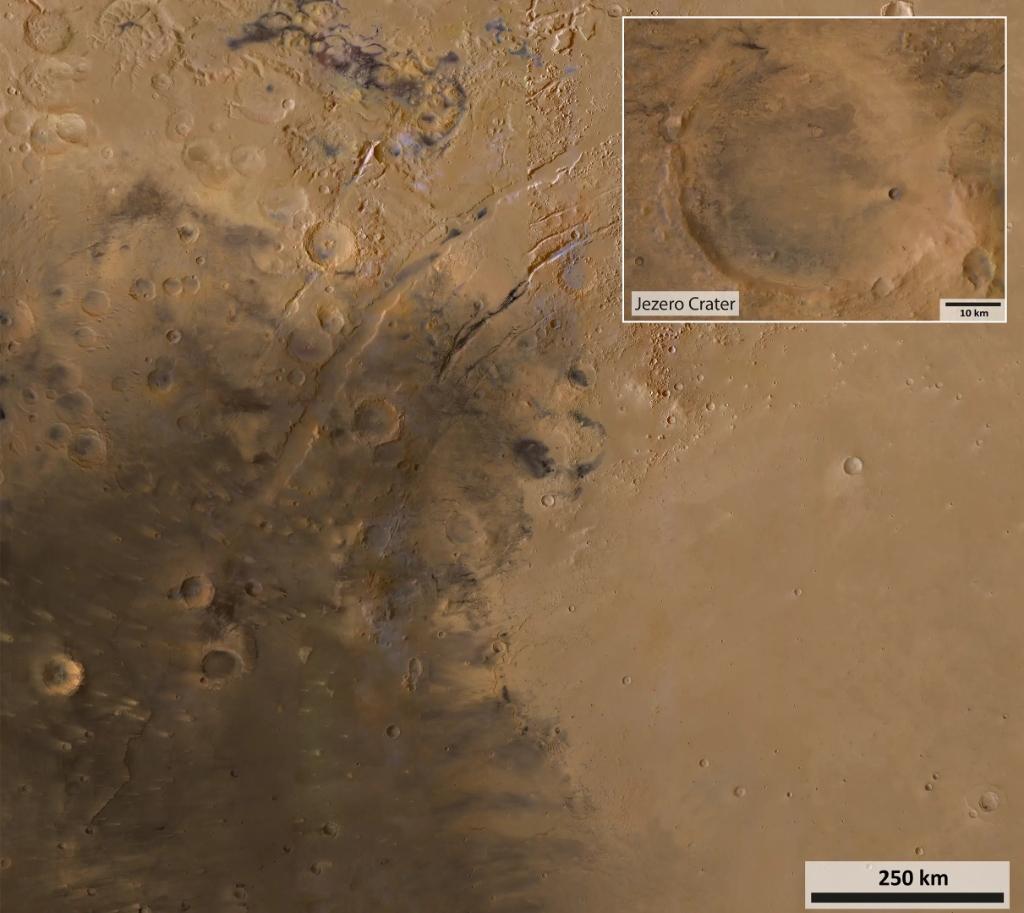
Jezero Crater
Ancient Paleolake & Western River Delta Architecture
As visible in the regional photograph, Jezero Crater sits exactly at the dramatic geological boundary where the dark, volcanic basaltic shield of Syrtis Major (left) descends into the vast, ancient golden basin of Isidis Planitia (right).
The close-up inset clearly captures the Western Delta Fan. Around 3.7 billion years ago, a massive river valley breached the crater’s western wall, depositing layered clays, mudstones, and carbonates into what was once a 250-meter-deep paleolake.
These fine-grained lacustrine sediments have the highest known potential to preserve micro-fossil organic biosignatures on Mars.
The darker units inside the crater floor correspond to the Séítah formation—an ancient olivine-rich igneous basement rock unit formed by volcanic magma ponding or impact melt, later exposed by wind erosion and dune fields.
Planetary Geospatial Capabilities
A focused toolset built to explore Martian spatial datasets and hypothetical rover traverses with transparent provenance for every data layer.
Dataset Visualization
Inspect Viking global mosaics, CTX basemaps, and HiRISE sub-meter imagery calibrated in OpenLayers using standard Mars 2000 cartographic projections.
Geological Context
Contextualize in situ rover observations and drill core locations with Jezero Crater's deltaic clay deposits and volcanic floor units.
Terrain Information
Study vertical relief, crater rim elevation profiles, and calculate slope inclinations to identify challenging terrain gradients.
Route-Planning Support
An experimental algorithm demonstration that evaluates hypothetical travel corridors between points of interest using terrain and slope weighting.
Past Exploration:
Humanity's Journey to the Red Planet
From grainy 1960s flyby snapshots to nuclear-powered robotic geologists, explore the missions that unlocked the secrets of Mars.
The First Flyby — Mariner 4 (NASA)
Captured the first close-up photographs of another planet.
Sent back 21 grainy images revealing a cratered, desert-like world rather than artificial "canals."
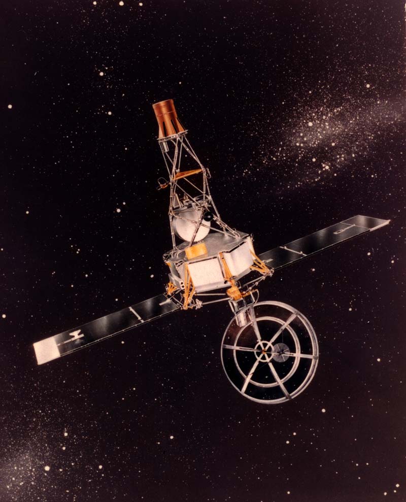
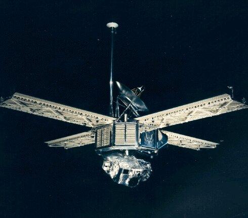
First Orbit & Soft Landing — Mariner 9 (NASA) & Mars 3 (USSR)
Mariner 9 became the first spacecraft to orbit Mars, mapping approximately 80% of its surface.
The Soviet Mars 3 achieved the first soft touchdown on Martian soil before losing contact after approximately 20 seconds.
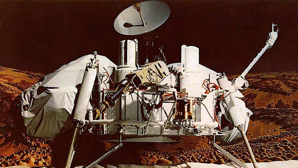
First Long-Term Surface Labs — Viking 1 & 2 (NASA)
The first successful landers to operate on Mars for extended periods.
Captured the first clear color panoramas from the surface and conducted biology experiments on Martian soil.
The First Wheeled Rover — Mars Pathfinder & Sojourner (NASA)
Deployed Sojourner, a microwave-sized, six-wheeled rover.
Demonstrated that mobile robots could navigate rocky Martian terrain and independently analyze rocks.
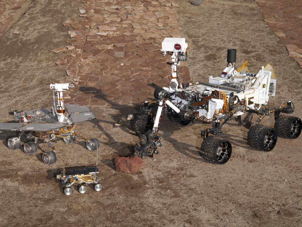
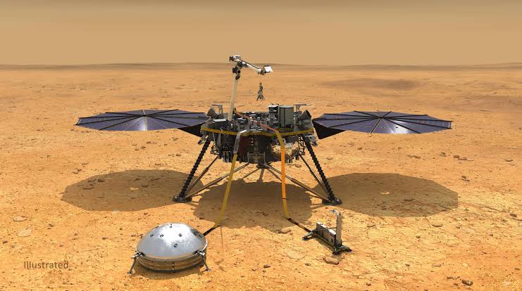
Water & Deep Interior — Spirit, Opportunity, Phoenix & InSight (NASA)
Spirit and Opportunity explored Mars for years, with Opportunity lasting over 14 years.
Their discoveries provided evidence of ancient liquid water. Phoenix uncovered subsurface water ice in 2008, while InSight studied the Martian interior and recorded more than 1,300 marsquakes.
MEET PERSEVERANCE — THE NEXT CHAPTER OF MARTIAN EXPLORATION
Landing on February 18, 2021, Perseverance is one of the most advanced robotic astrobiologists ever sent to Mars.
Exploring Jezero Crater, an ancient river delta and lakebed, its primary mission is to search for signs of ancient microbial life and collect core samples for possible future return to Earth.
Western rim of Jezero Crater, investigating ancient rocks in the Lac de Charmes region.
Traveled over 28.12 miles (45.25 km), breaking Opportunity's all-time off-world driving record in October 2026.
Approximately SUV-sized, 10 feet long, weighing around 2,260 lbs, powered by a plutonium-238 radioisotope power system.
FIVE THINGS THAT MAKE PERSEVERANCE EXTRAORDINARY
First Off-World Flight
Perseverance carried the Ingenuity helicopter, which completed 72 historic flights on Mars before retiring in 2024.
Making Oxygen on Mars
Its MOXIE instrument successfully converted carbon dioxide from the thin Martian atmosphere into oxygen, demonstrating technology relevant to future human exploration.
First Sounds of Mars
Its microphones recorded Martian wind, rover-wheel sounds, and laser zaps.
Rock-Vaporizing Laser
Its SuperCam instrument uses a laser to analyze the chemical composition of distant rock targets.
Hidden Passengers
The rover carries a microchip containing 10.9 million submitted names, alongside a meteorite fragment from Mars.
Think beyond boundaries.
Build with PROJECT ASTRA.
PROJECT ASTRA is a team of curious minds passionate about space, science, technology, and innovation. We believe in exploring ideas, conducting research, experimenting with technology, and turning creativity into meaningful solutions.
We welcome developers, researchers, designers, science enthusiasts, and curious learners who enjoy problem-solving and collaboration.

Prince Timilsina

Pragyan Thapaliya

Prabhat Dhoj Tulachan

Yug Pradhan

Dripshak Bachhar

Rijan Maharjan
Six minds. One mission. Infinite possibilities.
Your Exploration
Starts Here.
Open the dedicated dataset visualizer to inspect calibrated Mars imagery, observe Jezero’s river delta structures, and explore verified spatial layers.